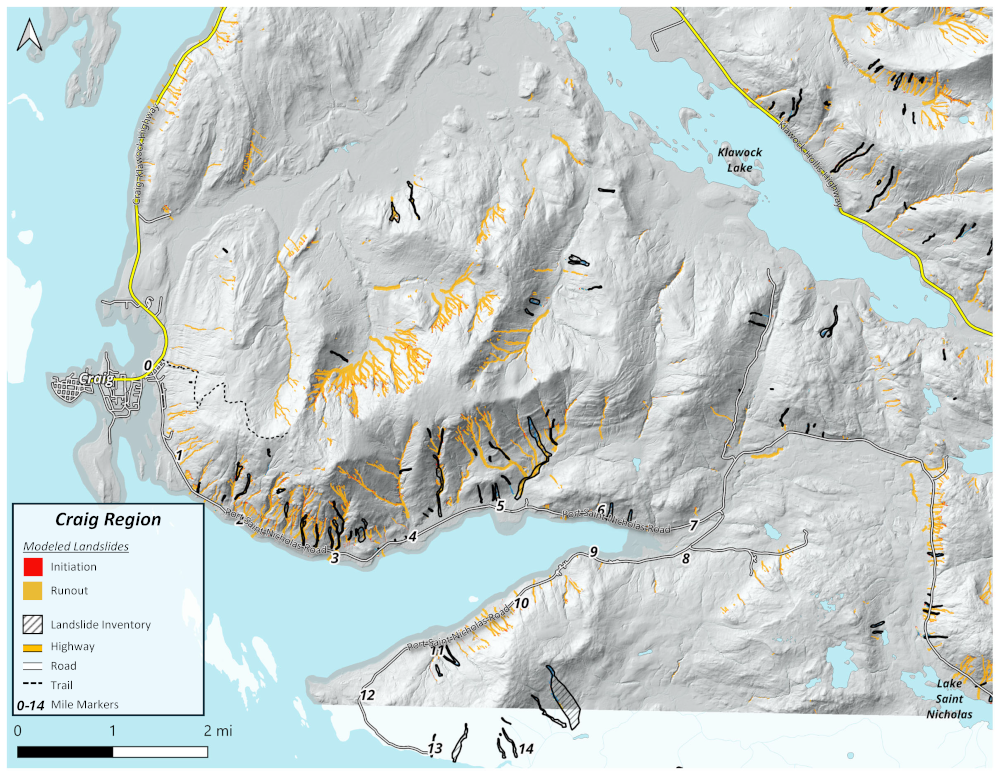
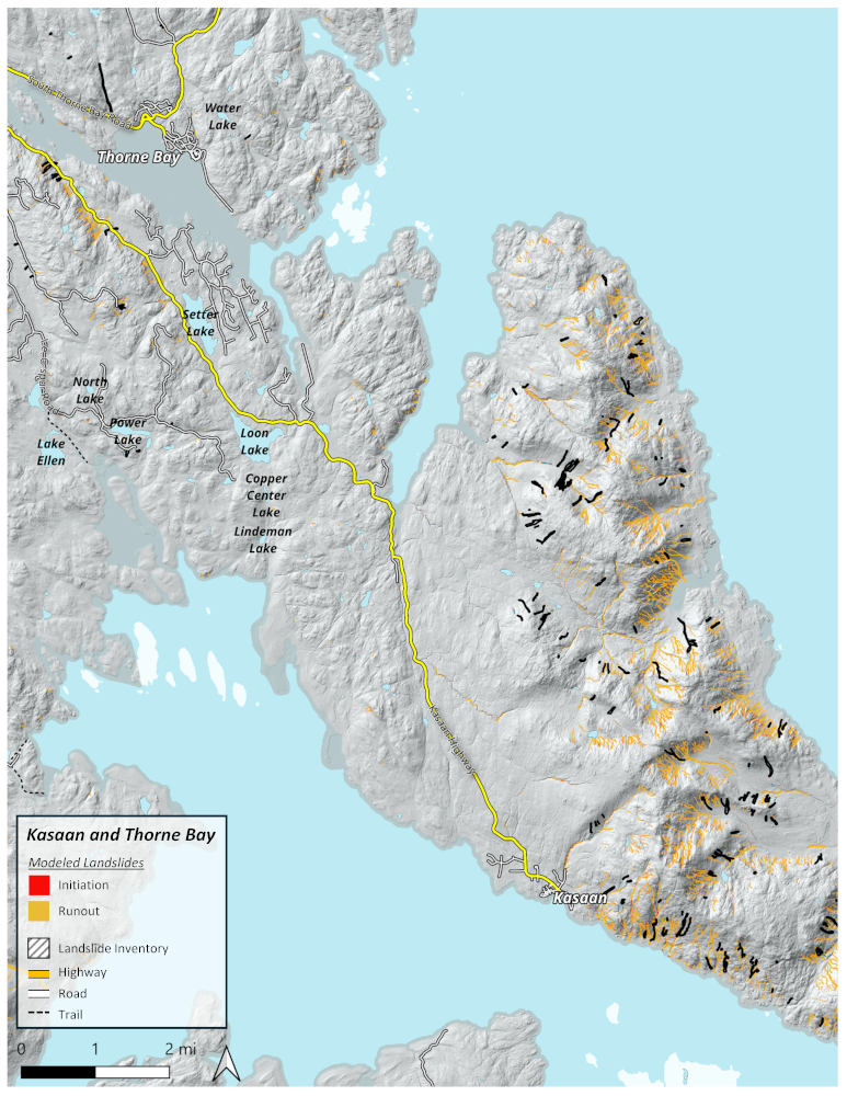
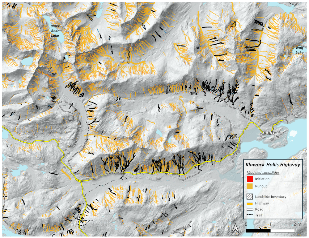
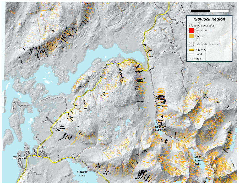
Landslide Hazard Maps
Below are maps that show where landslides are likely to occur on Prince of Wales Island. They include:
- The locations of previous landslides, mapped by the U.S. Forest Service (black, striped polygons)
- Model outputs showing where landslides are likely to occur in the future (red is where landslides start, yellow is where the landslide debris goes)
- Roadways and trails that may be at risk of landslides
The modeled landslides were developed using topography and estimates of soil characteristics, but soil is complex and varies by location, even in locations close together. Landslides may occur in places not identified as “at risk” by these maps.
Download the maps below to view them and print them out.